Erie Lackawanna
Railfan.net 'erielack' E-Mail List Photo Archive

Regional_Plan0001.jpg   Original: 498 by 816 pixels - Current: 498 by 816 - 100%
                          Try your mouse wheel too!
Previous Image - HPIM0744_2_s.jpg Regional_Plan0006.jpg - Next Image

From: "Jim Guthrie" jguthrie AT pipeline DOT com
Date: Sun, 4 Sep 2005 20:17:47 -0400
Subject: Re: (erielack) Re: ONE last "bigmap" > ?
"Regional_Plan0001.jpg" - image/jpeg, 180903 bytes, 498x816 (256c)

I've done a quick scan of a pair of relevant pictures along the Erie and NYC
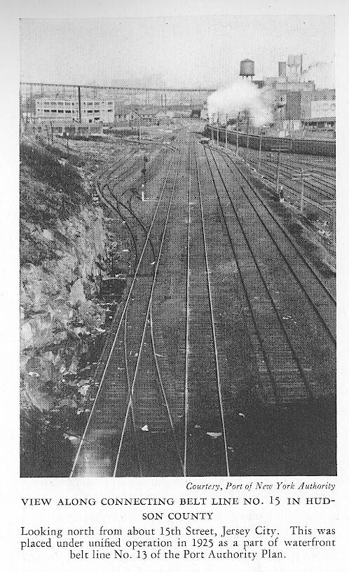
in Jersey City. The first is looking north from "around 15th Street" --
which I presume is the Holland Tunnel Ramp. Note that the caption also says
that this part was built by the Port Authority (although I really think the
PA trackage was actually looking south rather than north . . . but . . .

What are those tracks curving off to the left?

Note the spindly Hoboken El in the distance.

(Published in the New York Regional Plan -- 1929)

Cheers,
Jim


Regional_Plan0001.jpg

Click Here or on the corner X to close this window.


    All photos are the property of the original photographer unless otherwise noted and are to be used for personal viewing purposes only.

    The use of these photos on any website or other distribution media is strictly forbidden without the express consent of the image copyright holder.

    Linking directly to this page is permitted as long as "Railfan.net Erie Lackawanna Email List Photo Archive" is creditted on the linking page.